Remains of the Mablethorpe - Louth Railway

The single track branch railway from Louth was the first to reach Mablethorpe, opened on the 17th October 1877 by the Louth & East Coast Railway Company. Diverging south of Louth on the main East Lincolnshire Railway at Mablethorpe Junction, there were intermediate stations at Grimoldby, Saltfleetby, and Theddlethope. Further south, the Sutton & Willoughby Railway Company opened their line from Willougby on the East Lincolnshire Line to Sutton-on-Sea on 4th October 1866. This was subsequently extended to join the L&EC Railway's line at Mablethorpe on 14th September 1888. Thus forming the complete loop as illustrated in the British Rail map above.
The course of the Mablethorpe to Louth section is shown, when open, from the One Inch Ordnance Survey Map extracts below.


This early view looks North from Mablethorpe (LEYTR Collection).

A later view of Mablethorpe also looking North (LEYTR Collection)

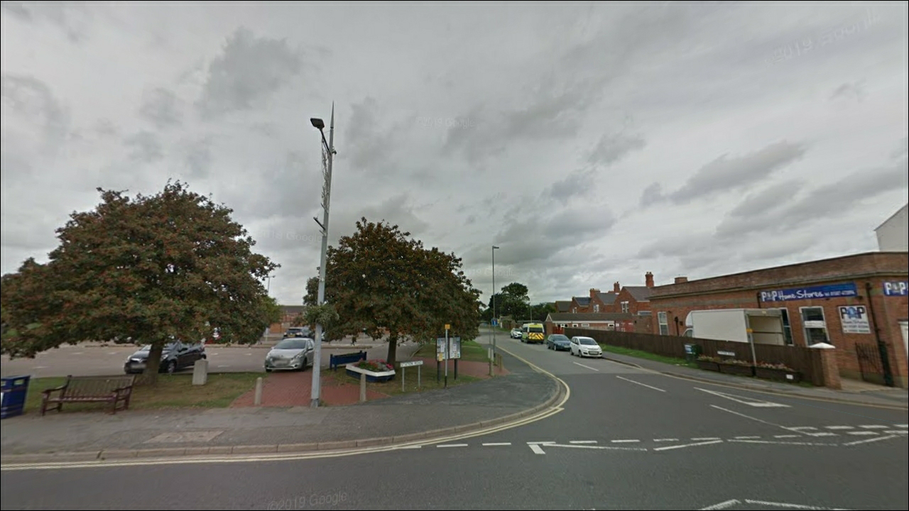
A contemporary view of the site of Mablethorpe station, looking North (Google Street View).
My photo taken in the 1980's shows some platform edging which is still there today.

My photo taken in the early 80's some distance up the line from the station looking North. The trackbed was well defined and used as a footpath at the time. Although the Mablethorpe to Louth line closed on the 5th December 1960, this short section was retained to stable excursion trains until the closure of the Mablethorpe to Willoughby section on 4th October 1970.

The contemporary Google Street View comparison shows the trackbed now redeveloped with housing.

A contemporary Google Street View scene from Enterprise Road. The line followed the row of bushes, Mablethorpe station to the right, and towards Louth on the left.

Further along Enterprise Road, a view of the trackbed towards Mablethorpe, now occupied by an industrial unit and Car Park.

Another from the same location looking in the opposite direction towards Louth. The footpath roughly follows the course of the railway. The Golf Road Crossing House is just visible in the distance (Google Street View).

Golf Road former level crossing looking towards Mablethorpe (Google Street View).

Golf Road level crossing and house looking towards Louth (Google Street View).

My early 1980's photo of the Crossing House. The raiway passed behind the fence, Left towards Louth, Right towards Mablethorpe.

Kent Avenue level crossing and house looking towards Mablethorpe (Google Street View).

Kent Road level crossing looking towards Louth (Google Street View).


Same location as above, looking towards Louth. The Crossing House is extant and just visible, albeit covered with ivy (Google Street View).

From the site of the former Level Crossing at Station Road, Theddlethope, the trackbed now built on in this view looking towards Mablethorpe (Google Street View).

From the same location, the trackbed looking towards Louth. The Theddlethope Station building is now a private residence. From 1934 it was possible to request the London & North Eastern Railway to locate a Camping Coach in the siding during the summer. This was then a regular fixed location for one during the summers of 1935 - 39. More about these can be read in this blog here. (Google Street View).

A further look at Theddlethope Station building from the former passenger approach road (Google Street View).

My photo of Theddlethope c.1985

Site of the former Back Street Level Crossing looking towards Mablethorpe (Google Street View).

From same location, the trackbed looking towards Louth and Crossing House (Google Street View).

Further view of Back Street Crossing House (Google Street View).

Trackbed looking towards Mablethorpe from the former Level Crossing with Marr Dyke B1200 (Google Street View).

Same location looking towards Louth and Marr Dyke Crossing House (Google Street View).

Further view of Marr Dyke Crossing House (Google Street View).

Bridge carrying driveway to Saltfleetby Station (My photo, 30th April 2019).

Still marked as "Station House" (My ohoto, 30th April 2019).

Station House at Saltfleetby viewed from approach road (My photo, 30th April 2019).

Station House, Saltfleetby (My photo, 30th April 2019).

Trackbed and Sation House at Saltfleetby looking towads Louth (My photo, 30th April 2019).

Same position as above, trackbed looking towards Mablethorpe (My photo, 30th April 2019).

Former North End Lane Level Crossing, trackbed looking towards Mablethorpe (Google Street View).

Same location as above, trackbed looking towards Louth (Google Street View).

From the former Ings Lane Level Crossing, trackbed looking towards Mablethorpe (Google Street View).

From the same location as above, trackbed loking towards Louth (Google Street View).

From the site of the former Eastfield Lane Level Crossing looking towards Mablethorpe (Google Street View).

Eastfield Lane Crossing House and trackbed, looking towards Louth (Google Street View).

Site of former level crossing at Tinkle Street, Grimoldby,trackbed now built on looking towards Mablethorpe (Google Street View).

From the same location looking, trackbed looking towards Louth and Grimoldby Station (Google Street View).

Grimoldby Station House (My photo, 30th April 2019). This was once the childhood home of the late famous actor Donald Pleasance whilst his father was Station Master there.

Railway gate at Grimoldby (My photo, 30th April 2019).

Looking at the site of the former Tinkle Street Level Crossing. Mablethorpe direction to the left, Louth to the right (My photo, 30th April 2019).

Unnamed road and site of former Level Crossing between Manby Road and Stewton Lane, looking towards Mablethorpe (Google Street View).

Same location as above, looking towards Louth (Google Street View).


LNER Working Timetable 7th October 1946 - 4th May 1947


Extract from the British Rail Sectional Appendix 1st October 1960

Tumetable leaflet for the line. Although dated until June 1961, the Mablethorpe to Louth section was closed on 5th December 1960. Note the solitary Steam Hauled train in the timetable, details of which are given at the end of this article.


